Alaska is a land of many geographical wonders, and one of the most surprising facts about this vast U.S. state is that it is both the easternmost and westernmost state in the country. At first, this sounds impossible how can a state be located in both the far east and the far west at the same time? The answer lies in the geography of the Aleutian Islands and the international dateline, which cuts across this remote part of Alaska. This unique positioning gives Alaska a rare claim not shared by any other U.S. state.
Understanding Alaska’s Geography
The Basics of Alaska’s Position
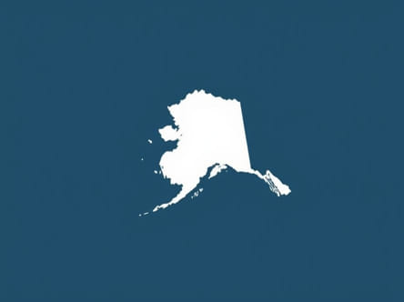
Alaska is located in the far northwest of North America. It borders Canada’s Yukon and British Columbia to the east, the Arctic Ocean to the north, and the Pacific Ocean to the south and west. While most of Alaska lies on the North American mainland, the state also includes the Aleutian Islands, a long chain of volcanic islands that stretch far into the Pacific Ocean.
This chain of islands curves westward, stretching across the 180th meridian also known as the International Date Line. This creates a unique geographic situation that leads to Alaska being in both hemispheres and, by standard definitions of longitude, being the easternmost and westernmost state in the United States.
Longitude and the International Date Line
To understand Alaska’s claim, it helps to look at how longitude works. The Earth is divided into 360 degrees of longitude, with the Prime Meridian at 0° running through Greenwich, England. Longitude increases as you move east or west from that point. The 180° line is directly opposite the Prime Meridian and marks the rough location of the International Date Line. In most of the world, this line runs through the Pacific Ocean, generally avoiding landmasses to minimize confusion about dates and time zones.
The Aleutian Islands stretch far enough to cross this 180° meridian, meaning that part of Alaska lies in the Eastern Hemisphere east of the Prime Meridian even though the mainland is firmly in the Western Hemisphere. This is what gives Alaska its rare geographic distinction.
Alaska as the Westernmost State
Attu Island and Its Location
Attu Island, the westernmost of the Aleutian Islands, is located at a longitude of approximately 173° East. While that may sound like it places the island in the east, it’s actually west of the 180° meridian when measured from Greenwich, making it the westernmost point of the United States.
Attu is part of the Near Islands group and is incredibly remote. It was once inhabited and used for military purposes during World War II but is now uninhabited. Despite its isolation, it marks the furthest west that any U.S. territory extends, earning Alaska the title of the westernmost U.S. state.
Alaska as the Easternmost State
Semisopochnoi Island Crosses the 180° Line
The true twist comes with Semisopochnoi Island, which is located just east of the 180° meridian at around 179° East. Because it lies in the Eastern Hemisphere, it technically qualifies as the easternmost point in the United States by longitude. While most would expect Maine or another East Coast state to hold this title, the geographic boundaries defined by longitude show otherwise.
This island is volcanic and uninhabited, and although few people ever visit it, its location gives Alaska the unusual distinction of being both the farthest west and farthest east among U.S. states.
Common Misconceptions
People Often Think of the Lower 48
Most people, when thinking of easternmost or westernmost states, picture the contiguous United States. They might guess that Maine is the easternmost or that California holds the westernmost title. These are correct only when considering the lower 48 states. However, once Alaska is included, the picture changes dramatically.
Hawaii and the Westernmost Confusion
Hawaii is often mistakenly thought of as the westernmost state due to its location in the Pacific Ocean. But because the Aleutian Islands of Alaska extend even farther west than Hawaii, this assumption is incorrect. Hawaii is indeed far west of the U.S. mainland, but not as far west as Alaska’s outer islands.
Why This Matters Geographically
Defining Hemispheres and Global Positioning
Geography is not just about land but also about how we divide the globe. The Prime Meridian and International Date Line are essential in defining time zones, days, and global coordinates. Alaska’s position challenges conventional thinking and reminds us that geography can be full of surprises. It also shows how human-created boundaries, like the dateline, influence how we view geography.
Impacts on Time Zones and Calendars
Because parts of Alaska are on either side of the 180th meridian, managing time and dates can be complicated. In practice, however, all of Alaska follows the Alaska Time Zone (AKST or AKDT), and exceptions are made to simplify timekeeping. This means the islands west of the 180° line observe the same date and time as the rest of the state, even though geographically they should be a day ahead.
Fun Facts About Alaska’s Geography
- Alaska has the highest peak in North America Denali, formerly known as Mount McKinley.
- It is the only U.S. state that lies within the Arctic Circle.
- Alaska is over twice the size of Texas but has a relatively small population.
- More than 3 million lakes can be found across Alaska.
- It shares a maritime border with Russia, only about 55 miles away at the closest point.
Summary of Key Geographic Points
- Westernmost PointAttu Island (173° East longitude)
- Easternmost PointSemisopochnoi Island (179° East longitude)
- ReasonThe Aleutian Islands cross the 180° meridian, placing part of Alaska in the Eastern Hemisphere
- State ClaimAlaska is both the easternmost and westernmost U.S. state by geographic definition
Alaska’s geographic uniqueness is not just about its size or rugged wilderness but also about how it interacts with global coordinates. Its stretch across the International Date Line via the Aleutian Islands makes it both the easternmost and westernmost state in the United States a fascinating fact that surprises many and highlights the complexities of geography. Whether viewed on a globe or a flat map, Alaska challenges our assumptions and reminds us that the world is full of unexpected details hidden in plain sight.