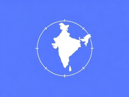
India, a vast and diverse country, stretches from the snow-covered peaks of the Himalayas in the north to the tropical coasts in the south, and from the arid deserts in the west to the dense forests and hills in the east. When exploring its geographical extremes, one of the most fascinating points is the easternmost longitude of India. This reference point is not only significant from a geographical and cartographical perspective, but it also plays a role in determining time zones, political boundaries, and cultural identity. The easternmost longitude marks the beginning of India’s day and stands as a geographic marker with both symbolic and scientific relevance.
Understanding Longitudes and Their Importance
What is Longitude?
Longitude refers to the vertical lines that run from the North Pole to the South Pole on the Earth’s surface. These lines help in determining the east-west position of a location on the globe. Measured in degrees (°), longitudes start from the Prime Meridian at 0° in Greenwich, London, and extend up to 180° east and 180° west. Longitudes are essential for navigation, timekeeping, and defining boundaries between countries and regions.
Why is the Easternmost Longitude Significant?
The easternmost longitude of India is important because it determines the first region of the country to experience sunrise. It also plays a part in the Indian Standard Time (IST), which is calculated based on a specific longitude close to the center of India. Moreover, knowing the extreme longitudinal and latitudinal points of a nation helps in accurate mapping and resource planning.
Location of India’s Easternmost Longitude
Exact Coordinates
The easternmost point of India lies near the village of Kibithu in Arunachal Pradesh, close to the border with China. The precise longitudinal coordinate of India’s easternmost point is approximately97°25² E. This point falls within the Anjaw district of Arunachal Pradesh, which is part of India’s northeastern region.
About Kibithu and Anjaw District
Kibithu is a small, remote village that holds strategic importance for India, not only because of its geographical location but also due to its proximity to the Line of Actual Control (LAC) with China. Anjaw district, one of the easternmost administrative districts in the country, is largely mountainous and forested, with limited infrastructure. The terrain is rugged, and weather conditions can be harsh, especially during the monsoon and winter seasons.
Easternmost vs. Easternmost Inhabited Point
Geographical Distinction
It’s important to distinguish between the absolute easternmost point of India and the easternmost inhabited location. While Kibithu is both geographically and demographically significant, some nearby locations may slightly extend eastward but remain uninhabited or are military-controlled zones. Therefore, for practical purposes and from a civilian perspective, Kibithu is commonly referred to as the easternmost inhabited place in India.
Strategic and Cultural Value
Despite its small population, Kibithu and surrounding areas hold cultural and strategic significance. The region is home to various tribal communities, including the Mishmi tribe, known for their distinct language and customs. The area also witnesses military activity due to its proximity to international borders, which adds to its national importance.
Relation to Indian Standard Time
IST and Longitude
Indian Standard Time (IST) is based on the 82.5° E longitude, which passes near Mirzapur in Uttar Pradesh. This central meridian was chosen as a compromise to maintain a single time zone across the country. However, the easternmost point at 97°25² E is nearly one hour and forty minutes ahead of IST in solar time. This leads to significant differences in sunrise and sunset times across the country.
Calls for Separate Time Zone
Given the disparity in daylight hours, there have been repeated suggestions to introduce a separate time zone for India’s northeastern states, including Arunachal Pradesh. A local time zone aligned more closely with the easternmost longitudes could benefit agriculture, education, and productivity by allowing the population to work more closely with natural daylight hours.
Physical Features of the Easternmost Region
Landscape and Climate
The area surrounding India’s easternmost longitude is dominated by hills, valleys, and thick forests. The Lohit River, a major tributary of the Brahmaputra, flows through the region. The terrain is often challenging to traverse and remains isolated from the mainland due to underdeveloped infrastructure. The climate ranges from temperate to sub-tropical, with heavy rainfall during monsoons and cold winters at higher elevations.
Biodiversity
This region is part of the Eastern Himalayas, one of the world’s biodiversity hotspots. It is home to rare flora and fauna, including orchids, red pandas, clouded leopards, and hornbills. The isolation and difficult access have helped preserve many of these ecosystems, although they are increasingly threatened by deforestation and development pressures.
Access and Connectivity
Reaching the Easternmost Point
Getting to the easternmost longitude of India is not an easy journey. The nearest major city is Tezu, which has a small airport and road connectivity. From there, one must travel by road to Walong and then proceed to Kibithu. The roads are narrow and winding, often affected by landslides and weather-related disruptions.
Efforts to Improve Infrastructure
In recent years, the Indian government has focused on improving connectivity in border areas. Road projects under the Border Roads Organisation (BRO) aim to strengthen logistics and improve civilian access. The development of new highways, communication networks, and airstrips are all part of a larger plan to integrate remote regions like Kibithu more closely with the rest of the country.
Conclusion and Future Outlook
Locating the easternmost longitude of India highlights both a geographic fact and a deeper story about the country’s diversity, border dynamics, and development challenges. At 97°25² E, this remote point in Arunachal Pradesh not only marks the beginning of India’s day but also underscores the need for balanced growth, strategic planning, and cultural preservation in India’s frontier regions. While often overlooked on the map, places like Kibithu carry immense national value and remind us that every corner of a country, no matter how distant, contributes to its identity and sovereignty. As infrastructure improves and awareness grows, the easternmost edge of India will likely gain more visibility and recognition both for its geographic significance and its role in the nation’s future development.