When looking at a map of the world, one of the most defining features that often goes unnoticed is the Equator. This invisible line runs horizontally around the center of the Earth and divides the planet into the Northern and Southern Hemispheres. While it may appear as a simple reference point, the Equator has immense geographical, climatic, and ecological significance. Understanding a map of the Equator offers insight into how this line influences global weather patterns, ecosystems, time zones, and even the culture of equatorial countries.
What is the Equator?
Definition and Geographical Importance
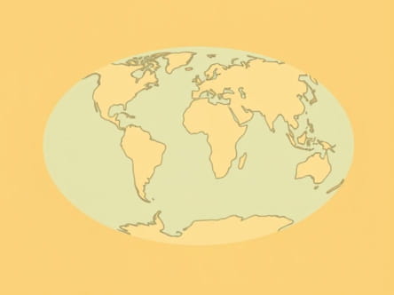
The Equator is an imaginary line that circles the Earth at 0 degrees latitude. It is the widest circumference of the planet, measuring approximately 40,075 kilometers (24,901 miles). On a map, the Equator appears as a straight horizontal line that cuts through the middle of the globe. It is equidistant from the North and South Poles and serves as the base reference point for measuring latitude north and south.
Why the Equator Matters
The Equator is not just a scientific concept it has practical implications. Areas along the Equator experience consistent daylight and nighttime hours year-round. These regions are also generally warmer and more humid due to direct sunlight hitting the Earth at a near-vertical angle. As a result, equatorial climates are often categorized as tropical.
Countries on the Equator
Continents the Equator Crosses
The Equator passes through three continents South America, Africa, and Asia (specifically, the island nations in Southeast Asia). Here’s a breakdown of countries the Equator runs through, which you can easily identify on a detailed map
- São Tomé and PrÃncipe (island nation in the Gulf of Guinea)
- Gabon
- Republic of the Congo
- Democratic Republic of the Congo
- Uganda
- Kenya
- Somalia
- Maldives (northernmost atolls near the Equator)
- Indonesia
- Ecuador
- Colombia
- Brazil
These countries often showcase diverse ecosystems, from dense rainforests to volcanic highlands, due to their equatorial position.
Climate Zones Along the Equator
Characteristics of Equatorial Climate
Maps of equatorial regions often highlight their climate zones, which are typically hot, humid, and wet. These zones experience little temperature variation throughout the year but may have distinct wet and dry seasons. The sun’s direct rays result in intense solar radiation, causing the air to rise rapidly and form clouds, leading to frequent rainfall.
Examples of Equatorial Climate Impact
- Amazon Rainforest (South America)Located in Brazil and neighboring countries, this dense forest is one of the most biodiverse places on Earth, thanks in part to its position near the Equator.
- Congo Basin (Africa)This second-largest rainforest after the Amazon is a vital ecological zone and home to unique species like gorillas and okapis.
- Indonesian ArchipelagoRich in volcanic soils and heavy rainfall, this region supports rice farming and lush jungle ecosystems.
Equator on a Map Physical vs. Political Views
Physical Maps
A physical map of the Equator highlights geographic features such as mountain ranges, rivers, lakes, and forests. In equatorial regions, such maps will show the Andes Mountains, Congo River, Lake Victoria, and other landmarks that play key roles in the local environment.
Political Maps
Political maps, on the other hand, emphasize borders and cities. When analyzing the Equator on a political map, you can observe how it intersects with various nations and even major cities, such as
- Quito, Ecuador – the closest capital city to the Equator
- Macapá, Brazil – divided directly by the Equator line
- Pontianak, Indonesia – known for its Equator monument
These cities often build their identity around their equatorial location, and you’ll find monuments or visitor centers marking the line.
Time Zones and the Equator
Equal Day and Night
Unlike higher latitudes that experience extreme changes in day length, places along the Equator enjoy nearly 12 hours of daylight and 12 hours of night throughout the year. This consistency has a significant impact on local agriculture, daily routines, and biological cycles.
Time Zone Patterns
Equatorial countries can span multiple time zones depending on their width. However, due to minimal seasonal shifts, they do not typically observe daylight saving time. This consistency simplifies timekeeping in equatorial regions, as seen in countries like Kenya or Indonesia.
Natural Phenomena on the Equator
Coriolis Effect
One interesting concept observed near the Equator is the Coriolis Effect. This refers to the way Earth’s rotation causes fluids (like air and water) to deflect to the right in the Northern Hemisphere and to the left in the Southern Hemisphere. At the Equator, the Coriolis Effect is essentially zero. This lack of rotational force is one reason hurricanes do not form directly over the Equator.
Solar Noon and the Zenith
At certain times of the year, the sun passes directly overhead at solar noon in equatorial regions. This event is known as the sun being at the zenith” and only occurs within the Tropics of Cancer and Capricorn. On the Equator, this phenomenon happens twice a year during the equinoxes.
Cultural and Economic Impact
Tourism and Identity
Many countries along the Equator embrace their location as a point of pride. They construct equator monuments, offer certificates for crossing the line, and educate visitors on its importance. These efforts help boost local tourism and generate economic activity.
Agriculture and Resources
The equatorial climate allows year-round farming of crops such as bananas, coffee, cocoa, and sugarcane. Because there is no true winter, planting and harvesting can occur continuously, offering economic advantages in agricultural productivity.
Challenges Faced by Equatorial Regions
Environmental Concerns
- DeforestationRapid development and agriculture have led to significant loss of forest cover, especially in the Amazon and Congo Basins.
- Climate ChangeRising temperatures and changing rainfall patterns can disrupt ecosystems and traditional farming cycles.
- Biodiversity ThreatsHabitat destruction endangers countless species unique to equatorial regions.
Infrastructure and Development
Equatorial regions, especially in Africa and parts of Asia, often face challenges related to infrastructure, education, and healthcare. While rich in natural resources, these areas sometimes struggle with economic disparity and political instability, limiting their ability to fully benefit from their geographic location.
Looking at a map of the Equator reveals far more than a simple line across the globe it uncovers a world of rich diversity, complex ecosystems, and vibrant cultures. Whether studying climate, agriculture, time zones, or global geography, the Equator serves as a crucial reference point. Understanding what it represents and how it impacts the world helps us better appreciate the delicate balance of life along the Earth’s middle. For educators, travelers, scientists, and curious minds alike, the map of the Equator is a gateway to exploring one of our planet’s most dynamic regions.