A map of the United States is one of the most familiar and widely used geographic tools in the world. It appears in classrooms, offices, books, news reports, and digital screens, helping people understand location, distance, and regional relationships. Beyond showing borders and names, a map of the United States tells a story about history, culture, natural landscapes, and how the country is organized. For students, travelers, and everyday readers, it offers a clear way to make sense of a large and diverse nation.
What a Map of the United States Shows
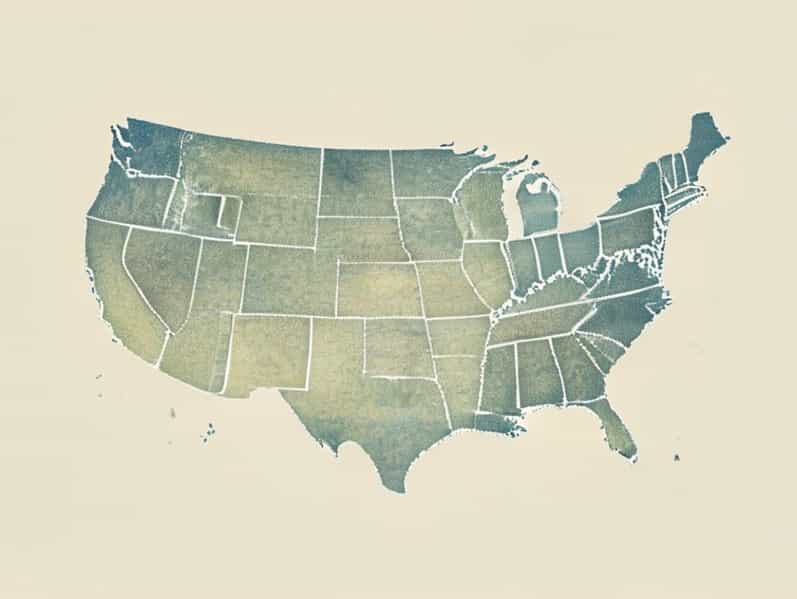
At its most basic level, a map of the United States displays the outline of the country and its internal divisions. This usually includes state boundaries, major cities, rivers, mountain ranges, and surrounding oceans. Depending on the type of map, additional information such as highways, population centers, or climate zones may also be included.
Maps help people visualize how places connect to one another. They show how far states are from each other, which regions share borders, and where important natural features are located.
The Structure of the United States on a Map
The United States consists of 50 states, but most maps focus on the contiguous or lower 48 states. Alaska and Hawaii are usually shown separately in smaller boxes to fit the layout of the map.
The country is bordered by Canada to the north and Mexico to the south, with the Atlantic Ocean on the east and the Pacific Ocean on the west. These borders help define the geographic position of the United States within North America.
The Contiguous United States
The contiguous United States stretches from the East Coast to the West Coast and includes most of the country’s population and major cities. This area contains a wide range of landscapes, from deserts and plains to forests and mountain ranges.
Alaska and Hawaii
Alaska is the largest state by land area and is located far northwest of the lower 48 states. Hawaii is a group of islands in the Pacific Ocean. On a map of the United States, both states are repositioned for convenience but remain essential parts of the nation.
Political Maps of the United States
A political map of the United States focuses on human-made boundaries. It highlights states, capitals, and major cities. Each state is clearly outlined, often in different colors, making it easy to identify individual states.
Political maps are commonly used in education, government, and media. They help people understand how the country is divided for administrative and political purposes.
States and Capitals
Each state has a capital city that serves as the center of its government. These capitals are marked on political maps and are important reference points for learning U.S. geography.
Physical Maps and Natural Features
A physical map of the United States highlights natural features rather than political borders. It shows mountains, rivers, lakes, deserts, and plains using colors and shading to represent elevation.
These maps help explain why certain regions developed differently based on terrain, climate, and access to water.
Mountain Ranges and Plains
Major mountain ranges such as the Rocky Mountains and the Appalachian Mountains are clearly visible on physical maps. Large plains, including the Great Plains, stretch across the central part of the country and have played a key role in agriculture.
Rivers and Lakes
Rivers like the Mississippi, Missouri, and Colorado are essential features on a map of the United States. The Great Lakes form one of the largest freshwater systems in the world and are a defining feature of the northern region.
Regional Divisions on U.S. Maps
Many maps divide the United States into regions to make understanding easier. Common regions include the Northeast, Midwest, South, and West. These regions are not official political divisions, but they reflect shared geographic and cultural characteristics.
Regional maps are useful for studying climate, economics, and population trends.
Educational Uses of a Map of the United States
Maps are essential tools in education. Students use a map of the United States to learn state names, locations, capitals, and geographic features. Over time, this builds spatial awareness and a better understanding of national geography.
Teachers often use different types of maps to explain history, migration, and economic development.
Thematic Maps of the United States
Thematic maps focus on specific topics rather than general geography. These maps might show population density, climate zones, election results, or economic activity.
- Population distribution maps
- Climate and weather maps
- Economic and industry maps
- Transportation and infrastructure maps
By presenting data visually, thematic maps make complex information easier to understand.
Maps and Travel Planning
A map of the United States is a valuable tool for travelers. It helps people plan routes, estimate distances, and understand regional differences. Road trips, in particular, rely on maps to visualize long journeys across states.
Even with digital navigation tools, having a general map view helps travelers see the bigger picture.
Digital Maps and Modern Technology
Today, most people interact with maps digitally. Online maps allow users to zoom, search for locations, and switch between different views. These tools make a map of the United States more interactive and accessible.
Despite these advances, the basic geographic layout remains the same, reinforcing the importance of foundational map knowledge.
Historical Changes Shown on Maps
Maps of the United States have changed over time. Historical maps show how the country expanded westward, how state borders were drawn, and how territories became states.
Comparing old and modern maps helps explain historical events and political decisions.
Why Maps of the United States Matter
Maps matter because they provide context. They help people understand where events happen, how regions differ, and how the country fits into the world.
From news reporting to education and planning, maps support informed decision-making.
Common Misunderstandings About U.S. Maps
One common misunderstanding is assuming all maps serve the same purpose. A political map may not show terrain clearly, while a physical map may not highlight cities.
Another issue is scale. Maps reduce reality, so distances and sizes must be interpreted carefully.
Using Maps to Understand Diversity
A map of the United States reveals the country’s diversity. Climate varies from arid deserts to humid coastlines, and population density differs widely between regions.
These variations help explain differences in lifestyle, economy, and culture across the nation.
a Map of the United States
A map of the United States is more than a collection of lines and labels. It is a powerful visual tool that connects geography with history, culture, and daily life. By studying maps, people gain a clearer understanding of how the country is shaped and how its regions relate to one another. Whether used for learning, travel, or general knowledge, a map of the United States remains an essential resource for understanding the nation as a whole.