Drainage patterns reveal a lot about the underlying structure and composition of the land. One particularly striking pattern is the trellis drainage system, characterized by a main river with numerous parallel tributaries that intersect at near right angles. This pattern resembles the structure of a garden trellis, hence the name. It is commonly found in areas where alternating bands of hard and soft rock have been folded or tilted, allowing water to carve out valleys along zones of weakness. One of the most notable examples of a trellis drainage pattern can be found in the Appalachian region of the eastern United States.
Understanding Trellis Drainage Pattern
Definition and Characteristics
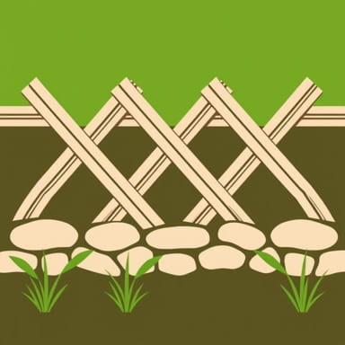
A trellis drainage pattern forms when tributaries run parallel to each other before joining a larger stream or river at right angles. The pattern often results from geological folding that causes a landscape to consist of alternating resistant and non-resistant rock layers. As rivers and streams erode the weaker rocks more easily, they create long, narrow valleys aligned in parallel. The resistant ridges force tributaries to flow in straight courses perpendicular to the main river, forming the distinctive trellis appearance.
Where It Forms
This pattern typically develops in areas with
- Folded mountains or hills
- Layered sedimentary rock formations
- Alternating ridges and valleys
- Strong geological control over erosion and water flow
The arrangement of the landscape has a strong influence on the drainage direction, channel slope, and stream velocity.
Example of a Trellis Drainage Pattern – Appalachian Mountains
Geological Setting of the Appalachians
The Appalachian Mountains provide a textbook example of a trellis drainage pattern. This ancient mountain chain stretches across the eastern United States, from Alabama in the south to Maine in the north. The Appalachians have been heavily folded and faulted over millions of years, producing a landscape with alternating hard and soft rock layers.
Rivers and Tributaries
In this region, many tributaries flow down narrow valleys between resistant ridges of sandstone or other hard rock. These tributaries meet larger rivers, such as the Tennessee, Potomac, or Delaware Rivers, at right angles, creating a trellis-like configuration. Some key examples include
- Potomac River SystemTributaries like the Cacapon River and the South Branch Potomac flow through valleys formed in weaker rock and meet the main river perpendicularly.
- Tennessee River BasinNumerous tributaries originate in the Ridge and Valley region and flow at right angles into the main river system.
Formation Process of Trellis Drainage
Role of Rock Resistance
As rivers flow across different rock types, erosion happens at different rates. Softer rocks like shale or limestone erode faster than harder rocks such as quartzite or sandstone. This differential erosion leads to the formation of valleys and ridges. Rivers naturally find paths of least resistance, resulting in the characteristic parallel streams aligned with valleys, while larger rivers cut through ridges at right angles.
Structural Influence
The folded and faulted strata of the Appalachians enhance the trellis pattern. When the land was uplifted and folded during ancient orogenic (mountain-building) events, it created long belts of resistant and weak rocks. As surface waters developed, they adjusted to this structural control, leading to the established pattern seen today.
Other Global Examples
Deccan Plateau, India
While the Deccan Plateau is better known for its radial and dendritic drainage patterns, localized areas, particularly where lava flows have formed linear ridges, may display limited trellis patterns. These are not as extensive as those in the Appalachian region but are still geologically relevant.
Zagros Mountains, Iran
The Zagros Mountains in western Iran exhibit a similar folded structure to the Appalachians. Rivers in this region often show trellis-like drainage influenced by the complex geologic structures and alternating lithologies, making it another potential example of this pattern outside the U.S.
Importance of Trellis Drainage Patterns
Indicators of Geological History
Trellis drainage patterns provide clues about the geologic past of a region. Their presence often indicates that the land has experienced tectonic compression, folding, and differential erosion over time. By studying the alignment of rivers and tributaries, geologists can infer the underlying rock types and structural formations.
Applications in Water Management
Understanding drainage patterns helps in planning water resource management, flood control, and soil conservation. In trellis systems, valleys may be prone to seasonal flooding due to their confined geography, and proper land use planning is essential.
Soil and Agriculture Implications
The valleys formed by erosion of softer rocks often contain fertile alluvial soils, making them suitable for agriculture. However, careful terracing and water retention strategies may be required to prevent erosion and maintain soil health.
Comparison with Other Drainage Patterns
Dendritic vs. Trellis
Dendritic patterns resemble the branching of tree limbs and occur in regions with uniform rock resistance. In contrast, trellis patterns occur in geologically varied terrains with alternating resistance. Trellis drainage is more angular and geometric than dendritic systems.
Radial vs. Trellis
Radial drainage systems form around conical features like volcanoes, where streams radiate outward. Trellis systems, by contrast, are confined by linear valleys and ridges, making them more rectilinear than circular.
The trellis drainage pattern is a visually distinct and geologically informative configuration of rivers and tributaries. Found most famously in the Appalachian Mountains, it demonstrates how terrain, rock type, and geological history influence the flow of water across a landscape. Studying such patterns not only enriches our understanding of Earth’s surface processes but also helps in land use planning, environmental management, and hazard mitigation. Whether in the hills of the United States, parts of Iran, or localized zones in India, trellis drainage stands out as a prime example of nature’s response to structure and resistance beneath the surface.