When thinking about the geography of the United States, Alaska often stands out as a state of extremes. It is famously the largest state by area, the coldest, and one of the most sparsely populated. But an intriguing question arises regarding its position on the globe is Alaska both the easternmost and westernmost state in the U.S.? At first glance, this might seem contradictory, yet the unique geography of Alaska, especially its location near the International Date Line, creates a fascinating case where it can claim both distinctions. Understanding how Alaska can be both easternmost and westernmost requires exploring geography, longitude, and how the globe is divided.
Geographical Location of Alaska
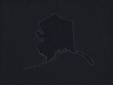
Alaska is located in the far northwest corner of North America, separated from the contiguous United States by Canada. It borders the Arctic and Pacific Oceans, as well as the Bering Sea and the Beaufort Sea. Its vast size stretches from roughly 130 degrees west longitude to beyond 170 degrees east longitude if you include the Aleutian Islands, which cross the 180-degree meridian (the International Date Line).
Alaska’s Unique Position on the Globe
- The majority of Alaska lies west of the contiguous 48 states.
- The Aleutian Islands chain extends far westward into the Pacific Ocean.
- Some of these islands cross the 180-degree meridian, which is considered the line dividing east and west on the globe.
This crossing of the 180-degree line is what causes Alaska to hold the unusual distinction of being both easternmost and westernmost.
Why Is Alaska Considered the Westernmost State?
By most standard maps and common understanding, Alaska is the westernmost state. This is because it extends farther west than any other U.S. state. The Aleutian Islands, which are part of Alaska, stretch deep into the Pacific Ocean and lie to the west of the rest of the country. The island of Attu, the westernmost of the Aleutian chain, is located at about 173 degrees east longitude, which is technically far west compared to the contiguous U.S.
Westernmost Point in the U.S.
- Attu IslandThe westernmost point of Alaska and the entire United States.
- Located just west of the 180-degree longitude line.
- Part of the Aleutian Islands, which form an arc extending far into the Pacific.
Because of the curvature of the Earth and the way longitudes are counted, Alaska’s Aleutian Islands are farthest west of the 50 states.
How Is Alaska Also the Easternmost State?
This is where geography becomes more interesting. The International Date Line, which runs roughly along the 180-degree longitude line, is an arbitrary but internationally recognized division for timekeeping and calendar purposes. Some of the Aleutian Islands actually lie just to the east of the 180-degree line, placing them technically in the Eastern Hemisphere.
Longitude lines are measured both east and west from the Prime Meridian at Greenwich, England. The 180-degree line is directly opposite the Prime Meridian and separates eastern longitudes (0° to 180° East) from western longitudes (0° to 180° West).
The Easternmost Point in Alaska
- The island of Semisopochnoi in the Aleutians is located just east of the 180-degree meridian.
- Because of this, it has an eastern longitude coordinate despite being part of Alaska.
- This makes Alaska technically the easternmost state as well.
So, even though Alaska is commonly thought of as the farthest west, parts of it actually extend into the Eastern Hemisphere, making it the easternmost state by longitude.
Understanding Longitude and Hemispheres
To fully grasp why Alaska can claim both titles, it helps to review how longitude works. Longitude measures how far east or west a point is from the Prime Meridian, which is 0 degrees longitude. Longitude values run from 0 to 180 degrees east or west.
The International Date Line approximately follows the 180-degree longitude but zigzags to avoid splitting countries and islands into two different days. Because the Aleutian Islands cross this line, they span both hemispheres. This creates the situation where parts of Alaska are farther east than the contiguous United States, which all lie in the Western Hemisphere.
How the Date Line Affects Alaska’s Position
- The Date Line curves around the Aleutian Islands to keep them all in the same day.
- This causes some Aleutian Islands to be located in the Eastern Hemisphere.
- Therefore, these islands have east longitude coordinates and are technically easternmost.
Comparison with Other U.S. States
Most other U.S. states are firmly located in the Western Hemisphere, making Alaska’s position unique. For example
- Hawaii, the next farthest west state, lies entirely in the Western Hemisphere but nowhere near the 180-degree longitude.
- The easternmost state on the mainland, Maine, is far east but still west of the 180-degree line.
- No other state crosses the 180-degree meridian like Alaska.
This geographical peculiarity sets Alaska apart in terms of longitude and hemispheric placement.
Practical Implications of Alaska’s Position
Alaska’s unique placement has interesting implications for time zones and calendar dates. For example, the Aleutian Islands follow the Hawaii-Aleutian Time Zone, which is behind the rest of the country by several hours. The International Date Line shift means that the islands east of the line experience the same calendar day as the rest of Alaska, even though they are technically in the Eastern Hemisphere.
This setup helps maintain consistency for residents, businesses, and government operations across the state, despite the unusual geographic position.
Time Zones in Alaska
- Alaska Standard Time (AKST) for most of the state
- Hawaii-Aleutian Standard Time (HAST) for the western Aleutian Islands
The time zones help manage the vast area of the state and its unique position relative to the globe.
In summary, Alaska is indeed both the easternmost and westernmost state in the United States when viewed through the lens of longitude and hemispheres. The vastness of the state, combined with the Aleutian Islands crossing the 180-degree longitude, creates this rare geographic distinction. Alaska’s position highlights the complexities of mapping our globe and the arbitrary nature of human-made boundaries like the International Date Line. Whether you think of Alaska as far west or far east depends on your perspective and understanding of geography, but the facts show that Alaska uniquely holds both titles in one vast, beautiful state.