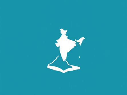
Far from the bustling cities and well-known landmarks of mainland India lies a remote and significant point in the country’s geographic boundaries the easternmost point of India. Tucked away in the eastern reaches of Arunachal Pradesh, near the tri-junction with China and Myanmar, this location holds both strategic and symbolic value. The easternmost point is often associated with the village of Kibithu, which falls under Anjaw district. What makes this location particularly notable, beyond its political and military importance, is its precise geographical coordinates, especially its latitude. Understanding the latitude of the easternmost point of India offers insights into the country’s vast territorial span and the remarkable diversity of its terrain.
Geographic Significance of India’s Easternmost Point
Location Overview
The easternmost point of India lies near Kibithu, a small settlement located in the Anjaw district of Arunachal Pradesh. This area forms part of the easternmost extremity of the Indian mainland and is situated close to the India-China border. The region is mountainous, remote, and covered with lush green forests, traversed by the Lohit River, a tributary of the Brahmaputra.
Precise Coordinates
The geographic coordinates of India’s easternmost point near Kibithu are approximately
- Latitude28.167° N
- Longitude97.013° E
While longitude marks how far east or west a place is, the latitude 28.167 degrees North in this case places it just above the Tropic of Cancer. This position means the area experiences a subtropical to temperate climate, depending on altitude.
Understanding Latitude and Its Importance
What is Latitude?
Latitude is a geographical coordinate that specifies the north-south position of a point on the Earth’s surface. Measured in degrees, latitude ranges from 0° at the Equator to 90° at the poles. In the case of the easternmost point of India, the latitude of approximately 28.167° N places it in the Northern Hemisphere, relatively close to the Himalayan mountain range.
Why Latitude Matters
Latitude affects several environmental and climatic factors such as
- Day lengthHigher latitudes experience greater seasonal variation in daylight hours.
- ClimateThe farther from the equator, the cooler the average temperature, especially in elevated terrain.
- AgricultureLatitude can influence growing seasons and the types of crops that can be cultivated.
In regions like Kibithu, the combination of latitude and altitude results in a moderate climate, with cooler temperatures than most other parts of the country.
Strategic and Cultural Importance of the Region
Border Location
Kibithu is located near the Line of Actual Control (LAC), making it of high strategic significance to India. The Indian Army maintains a strong presence in this region, and the area has witnessed military activities and infrastructure development in recent years.
Indigenous Communities
The area is inhabited by local tribes such as the Mishmi people, who have lived here for centuries. These communities have their own unique languages, customs, and cultural practices. The remote setting has helped preserve their traditional way of life, although modernization is slowly making its way into the region.
Tourism and Restricted Access
Due to its sensitive location, access to Kibithu and nearby areas is limited and requires special permits. Despite this, the natural beauty and serene environment attract a small number of adventure tourists and trekkers. The combination of cultural richness and geographic isolation makes it a compelling, if lesser-known, destination.
Comparison with Other Extreme Points of India
To appreciate the full geographic span of India, it’s helpful to compare its easternmost point with the country’s other extreme locations
- Northernmost PointIndira Col in Siachen Glacier, Jammu & Kashmir
- Southernmost PointIndira Point, Great Nicobar Island (6.746° N)
- Westernmost PointGuhar Moti, Gujarat (68.176° E)
- Easternmost PointKibithu, Arunachal Pradesh (97.013° E, 28.167° N)
This geographical spread demonstrates the wide diversity of climate zones, languages, cultures, and landscapes that fall within Indian territory. From the icy mountains of Ladakh to the tropical jungles of the Andaman and Nicobar Islands, India’s extremities are points of national pride and geographic interest.
Environmental Conditions at 28.167° N
Climate Characteristics
The latitude of 28.167° N places the easternmost point of India in a transitional climate zone. Influenced by both subtropical and alpine patterns, the region sees significant rainfall during the monsoon months, especially from June to September. Winters are cool to cold, depending on elevation, with snow falling in higher altitudes.
Biodiversity and Forest Cover
The forests in this part of Arunachal Pradesh are rich in biodiversity. The flora includes rhododendrons, bamboo groves, and pine species, while the fauna features a variety of birds, butterflies, and mammals like Himalayan black bears and red pandas. The relatively untouched ecosystems are a haven for researchers and ecologists.
Connectivity and Infrastructure
Road and Communication Links
Reaching the easternmost point of India is not easy. The roads are often winding, narrow, and vulnerable to landslides. However, in recent years, the Indian government has improved connectivity by constructing roads under strategic initiatives. Mobile network access is still limited, but slowly expanding.
Future Development Plans
With growing awareness of the importance of India’s border regions, there are plans to improve transportation and digital infrastructure in areas like Anjaw district. These efforts aim to enhance both civilian life and military readiness in remote border zones.
Interesting Facts About Kibithu and Its Latitude
- Kibithu is one of the first places in India to witness sunrise due to its location in the easternmost part of the country.
- The village is situated at an elevation of about 1,240 meters above sea level.
- It is only a few kilometers from the McMahon Line, the de facto boundary between India and China.
- The area falls under India’s Look East and Act East policy focus, aimed at strengthening ties with Southeast Asia.
- The Lohit River valley nearby is considered one of the most scenic and unexplored regions in Northeast India.
The easternmost point of India, located near Kibithu in Arunachal Pradesh, holds more than just a place on the map. Its latitude of 28.167° N reveals much about its climate, ecosystem, and position within the broader geography of the subcontinent. This area symbolizes both the geographic limits of the Indian nation and the resilience of its border communities. As India continues to grow in regional influence, understanding and valuing such remote areas becomes increasingly important, both for national security and cultural preservation.