The Ganga Brahmaputra basin is one of the most extensive and fertile river basins in the world, supporting millions of people and shaping the cultural, agricultural, and economic life of South Asia. This vast drainage system is formed by two mighty river systems, the Ganga and the Brahmaputra, along with their numerous tributaries. In India, the basin spreads across a wide range of landscapes, from the Himalayas to the coastal plains, influencing climate, settlement patterns, and natural resources. Understanding the states in which the Ganga Brahmaputra basin lies helps explain its importance to India’s geography and development.
Understanding the Ganga Brahmaputra Basin
The Ganga Brahmaputra basin refers to the combined drainage area of the Ganga river system and the Brahmaputra river system. These rivers originate in the Himalayan region and flow through plains before finally draining into the Bay of Bengal. The basin is characterized by rich alluvial soil, dense river networks, and a high population density.
In India, the basin covers a significant portion of the northern and northeastern parts of the country. The rivers provide water for irrigation, drinking, industry, and transportation, making the basin crucial for national food security and livelihoods.
Geographical Spread of the Basin in India
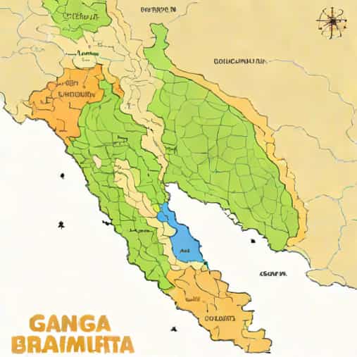
The Ganga Brahmaputra basin lies across several Indian states, each with its own physical features and socio-economic importance. The basin includes Himalayan states, northern plains states, eastern states, and northeastern states. Together, these regions form a continuous river system that supports agriculture, biodiversity, and human settlements.
States Covered by the Ganga River System
The Ganga river system covers a large part of northern and eastern India. The main river and its tributaries flow through multiple states, shaping their geography and economy.
Uttarakhand
Uttarakhand is one of the most important states in the Ganga Brahmaputra basin because it is where the Ganga originates. The river begins as the Bhagirathi and Alaknanda rivers, which meet at Devprayag to form the Ganga. The mountainous terrain of Uttarakhand gives rise to fast-flowing rivers that carry sediments downstream.
This state plays a vital role in water supply, hydropower generation, and religious tourism. The upper Ganga basin in Uttarakhand is also ecologically sensitive and rich in biodiversity.
Uttar Pradesh
Uttar Pradesh is the largest and most populous state through which the Ganga flows. The river and its tributaries such as the Yamuna, Ghaghara, and Gomti irrigate vast agricultural lands. The fertile plains of Uttar Pradesh form the heart of the Ganga basin.
Agriculture, especially rice, wheat, and sugarcane cultivation, depends heavily on the river system. Many major cities and cultural centers have developed along the banks of the Ganga in this state.
Bihar
Bihar lies entirely within the Ganga basin and is deeply influenced by the river and its tributaries. Rivers such as the Gandak, Kosi, and Son contribute to the basin’s extensive network.
The state benefits from fertile alluvial soil, but it also faces challenges such as frequent floods. Despite these challenges, the Ganga Brahmaputra basin supports agriculture and livelihoods across Bihar.
Jharkhand
Jharkhand forms an important part of the Ganga basin through rivers like the Damodar and the Son. These rivers originate in the plateau region and flow toward the Ganga.
The basin area in Jharkhand supports agriculture, mining, and industry. Dams and reservoirs on these rivers play a key role in irrigation and power generation.
West Bengal
West Bengal is a crucial state in the lower Ganga basin. The river enters the state and splits into several distributaries, forming a complex delta system before entering the Bay of Bengal.
The Ganga Brahmaputra basin in West Bengal supports rice cultivation, fisheries, and inland water transport. The delta region is also home to unique ecosystems and dense human settlements.
States Covered by the Brahmaputra River System
The Brahmaputra river system mainly influences the northeastern part of India. It flows through mountainous and plain regions, contributing to the diversity of the basin.
Arunachal Pradesh
Arunachal Pradesh is where the Brahmaputra enters India, known locally as the Siang or Dihang river. The river descends from the Himalayas, creating deep valleys and gorges.
This region is rich in hydropower potential and biodiversity. The upper Brahmaputra basin in Arunachal Pradesh is less densely populated but environmentally significant.
Assam
Assam is the most prominent state in the Brahmaputra basin. The river flows across the length of the state, creating a wide floodplain that supports agriculture and settlements.
The basin in Assam is known for its fertile soil, tea plantations, and wetlands. Seasonal flooding is common, shaping both challenges and opportunities for the region.
Meghalaya
Although Meghalaya does not lie directly on the main course of the Brahmaputra, several tributaries originate here and flow into the river. These rivers contribute to the overall drainage system of the Ganga Brahmaputra basin.
The high rainfall in Meghalaya feeds the river system and supports lush vegetation and agriculture.
Sikkim
Sikkim is part of the Ganga basin through the Teesta river, an important tributary of the Ganga. The Teesta flows from the Himalayan glaciers and passes through Sikkim before entering West Bengal.
The basin area in Sikkim is important for hydropower generation and mountain agriculture.
Importance of the Basin States
The states in which the Ganga Brahmaputra basin lies are among the most productive and densely populated regions of India. Together, they contribute significantly to food production, water resources, and economic activities.
The basin supports
- Large-scale agriculture and irrigation
- Inland water transport and trade
- Hydropower and energy generation
- Rich cultural and religious heritage
Environmental and Social Challenges
While the Ganga Brahmaputra basin brings immense benefits, it also faces challenges such as flooding, erosion, pollution, and climate change impacts. States within the basin must balance development with environmental conservation.
Population pressure and industrial growth have increased stress on river systems, making sustainable management essential.
Role in India’s Geography
The Ganga Brahmaputra basin shapes India’s physical geography by creating fertile plains, deltas, and wetlands. It influences climate patterns, supports biodiversity, and acts as a natural corridor for human movement and settlement.
The states in which the Ganga Brahmaputra basin lies form the backbone of India’s river-based geography. From Uttarakhand and Uttar Pradesh in the north to Assam and West Bengal in the east, the basin connects diverse regions through water, soil, and culture. Understanding these states and their relationship with the river systems highlights the basin’s critical role in India’s environmental stability, economic growth, and human development. The Ganga Brahmaputra basin remains not just a geographical feature, but a lifeline for millions of people across the country.