When an earthquake occurs, the sudden release of energy causes the ground to shake, often with devastating results. But long before we feel the tremors with our bodies, sensitive instruments known as seismographs are already recording the earth’s movements. These devices are crucial tools in the field of seismology, helping scientists to detect, measure, and analyze seismic activity. The ability to record earthquake evidence on a seismograph is essential for understanding the structure of the Earth’s interior, predicting seismic hazards, and improving safety measures in vulnerable areas.
What Is a Seismograph?
Basic Definition and Function
A seismograph is a scientific instrument used to detect and record the vibrations caused by seismic waves as they travel through the Earth. These instruments are highly sensitive and can pick up even the slightest ground motion. The output from a seismograph is called a seismogram, which displays the data in the form of wavy lines on paper or a digital screen.
Components of a Seismograph
- Mass (or Pendulum)A weight that remains stationary as the ground moves during an earthquake.
- FrameThe structure connected to the ground, which moves during seismic activity.
- Recording DeviceMechanism that traces the relative motion between the mass and the Earth, usually through a pen on paper or digital sensor.
As the Earth shakes, the frame of the seismograph moves with it, while the suspended mass stays in place due to inertia. The difference between the two motions is what gets recorded as a seismogram.
How Seismographs Record Earthquakes
Seismic Waves and Ground Motion
Earthquakes generate seismic waves that travel through the Earth’s crust. These waves come in different types, including
- P-waves (Primary Waves)The fastest waves, traveling through both solids and liquids.
- S-waves (Secondary Waves)Slower than P-waves and can only move through solids.
- Surface WavesThe slowest but most destructive waves, traveling along the Earth’s surface.
Seismographs detect and record these waves in the order they arrive. The first small, rapid movements on the seismogram represent P-waves, followed by larger S-waves, and finally surface waves, which usually cause the most noticeable shaking.
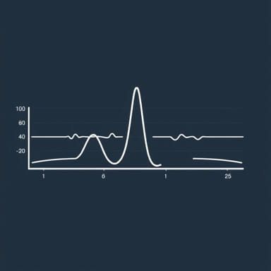
Seismogram Interpretation
A seismogram is a graphical representation of ground motion over time. Scientists analyze the timing and amplitude of the waves to determine
- When the earthquake occurred(based on the arrival time of the waves).
- Where the earthquake happened(by triangulating data from multiple seismograph stations).
- How strong it was(using wave amplitude and duration).
Using a Seismograph to Locate an Earthquake
Triangulation Method
To locate the epicenter of an earthquake, scientists use data from at least three seismograph stations. The key steps include
- Measure the time difference between P-waves and S-waves.
- Use this difference to calculate the distance from each station to the epicenter.
- Draw circles around each station with radii equal to the calculated distances.
- The point where all circles intersect is the earthquake’s epicenter.
Importance of Multiple Stations
A single seismograph can only determine how far the quake was, not the direction. That’s why seismic networks around the world are vital. They provide a comprehensive view of global seismic activity and allow precise localization of even small tremors.
Magnitude and Intensity Measurements
Richter Scale and Moment Magnitude
The original method for measuring earthquake magnitude was the Richter scale, which is logarithmic. Each whole number increase represents a tenfold increase in wave amplitude. Today, the moment magnitude scale (Mw) is more commonly used because it provides more accurate estimates for large earthquakes by factoring in fault area and ground displacement.
Seismographs and Magnitude
Seismographs are essential for calculating magnitude. They measure the amplitude of the seismic waves and the duration of shaking. By analyzing multiple seismograms, scientists can accurately determine how powerful an earthquake was.
Historical Importance of Seismographs
Early Developments
The first crude seismographs were developed in ancient China, but modern seismology began in the 19th century with mechanical devices that used pendulums and pens. These instruments laid the groundwork for understanding seismic activity and building safety standards.
Modern Digital Seismographs
Today, most seismographs are digital and can transmit data in real time to seismic monitoring centers around the globe. These modern instruments are extremely sensitive and can detect earthquakes from thousands of kilometers away.
Applications Beyond Earthquakes
Monitoring Volcanic Activity
Seismographs are also used to detect ground tremors caused by magma movement beneath volcanoes. This helps volcanologists forecast eruptions and issue warnings to nearby populations.
Engineering and Construction
Engineers use seismic data to design buildings and infrastructure that can withstand earthquakes. Seismograph records help identify seismic zones and guide the implementation of building codes and regulations.
Understanding Earth’s Interior
By analyzing how seismic waves travel through the Earth, scientists can infer the structure and composition of its interior layers. This has led to discoveries such as the existence of the Earth’s liquid outer core and solid inner core.
Educational and Public Awareness Roles
Teaching Tools
Seismographs are frequently used in schools and universities to teach students about plate tectonics, wave behavior, and geology. Demonstrating how to record and interpret a seismogram provides hands-on learning about the dynamic nature of the Earth.
Public Safety and Early Warning
Some regions have implemented early warning systems based on seismograph data. These systems can detect the first P-waves and issue alerts seconds before the more destructive S-waves and surface waves arrive. Even a few seconds of warning can allow people to take cover, stop trains, and shut down industrial operations.
Recording earthquake evidence on a seismograph is a vital part of modern geoscience. Seismographs do much more than simply register the shaking of the ground; they help scientists understand where and why earthquakes occur, how strong they are, and what kind of damage they might cause. They are tools of knowledge, safety, and scientific discovery. Whether installed deep underground or placed on the surface in urban areas, these instruments quietly collect the data that helps us prepare for and respond to one of nature’s most powerful forces.